


L2S2 SATIS Tally is the purpose designed person registration and management tracker for first responders and event managers.
What’s new in July 2017
• Nested dashboards scale to very large systems
• GPS coordinates returned from iPhone with data
• Real-time map view shows location where data was captured
• Print header with captured field data on data collection forms and labels
• Enhanced user customisation of dashboard text
• Intelligent device caching improves offline performance
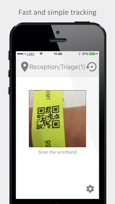
Register Persons
• Quickly register QR or bar code wristbands using device camera
• Get information about the registrant in real-time
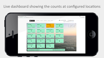
• Know what is happening in real-time through smart web dashboard
Locations
• Set and name your own locations/ zones/ activities on the web
• All devices update immediately
• The tiles on the dashboard display your names
• Choose a location on your device
• Single-click update to refresh dashboard
Alerts
• Set count alerts and colours to highlight problems
• Dashboard tiles will show the status of all locations
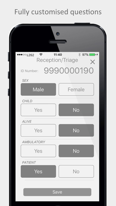
Questions
• Define your own simple key questions on the web
• All devices update questions automatically
• Use to get the information you need to control resources
Counters
• Display the highest priority information to show for each location
• Chose up to two key question counts to display
• Design how the information will appear
Users
• Create new users and register more devices
• Assign users’ mobile, admin and dashboard permissions
Data
• Export dashboard data in CSV format
Appearance
• Set background image
• Change several of the fonts, colours and text
Nested Dashboards
• Link dashboards together to scale to very large systems
• Built-in consent mechanism to invite-in new dashboards
Smart Printing
• Print header strips containing time and date of scan, answers to questions and ID QR code
• Print to Leitz Icon label printer or A4 paper
Mapping
• Devices optionally return GPS coordinates with data
• Built-in plotting on map shows locations of data captured
• Hover over map pins to see data captured at the pin location